
In November/December 2018 I took my third trip to the Yucatán Peninsula in Mexico. I’d first gone there back in 2014. I had decided to go after hearing stories a friend had told me about the ruins of 19th-century haciendas and old, half-abandoned churches damaged in the Caste War (1847–1901). After giving me tips on books to read in order to find these sites, he put me in touch with a local photographer named Baltasar (Balta) Castro Cocom. Balta and I became friends online. Even though I was planning to spend the bulk of my time visiting the haciendas and churches, Balta offered to take me to see some remote Mayan ruins.

This maps shows that Mayan ruins are dotted all over the Yucatán peninsula
We went out for a weekend to the Puuc area south of Mérida and I was stunned by what he showed me. Though I did photograph some haciendas and even produced a small photo series on Caste War churches, it was the ancient Mayan ruins that fascinated me. And though I did visit Uxmal, Sayil, Labna, and other famous, publicly-accessible sites, it was the smaller, off-the-beaten-track ruins, some deep in the jungle, almost completely covered in vegetation, that Balta showed me that captured my heart and my imagination.
Photographing the ruins, on the other hand, was not easy. There are few open spaces, and the ruins are jumbled and sometimes covered in dense vegetation, so access and compositions are often difficult, but even more difficult was the light. We were often at sites near midday with harsh, contrasty, dappled light shining through the jungle canopy. After struggling for a little while at our first site, the amazing Xkichmook, I tried an infrared (IR) filter. I have an old Singh Ray IR filter that is like a piece of welding glass—it gives the equivalent of about 16 stops of filtration—so I didn’t use it that often. Not only did the infrared deal pretty well with the lighting conditions, it created a dreamy, otherworldly look that perfectly reflected the wonder and awe I felt seeing these ruins hidden away in the jungle. I was so taken with the few (not really very good) IR images I shot on that trip that I decided to convert a camera to IR and plan a return trip, which happened in March 2016. Now, in 2018, I had come back for a third trip to continue working on my series of Mayan ruins images in infrared. As Balta was only available for a long weekend, I travelled for the first few days with explorer/ruins hunter Dan Griffin. As well, when I met up with Balta I got to meet and explore with renowned Mayanist Stephan Merk, as well as to travel with Mexican photographers I’d met over the last four years online.
I arrived in Mérida, where Dan picked me up at the airport. We headed out immediately to the Puuc, photographing at the site of Xchoralche. The height of Mayan civilization in the Puuc area happened during Late Classic period of Mayan history - between 700AD and 1000AD. Though I have travelled as far south as Calakmul (near the Guatemalan border) in 2016, the ruins in the Puuc style are my favourite to photograph and I was happy to be spending this whole trip in that area.
On our first full day, we visited the wonderful site of Kom. That day we experienced everything from biting ants, 3-km drives into the forest that took 30 minutes and a sweaty climb up a 70- foot high collapsed stairway to breath-takingly beautiful ruins and gorgeous light for infrared images.

One of the smaller buildings near the entrance to Kom.

Fallen ruins at Kom.

Photographing at the amazing and large site of Kom.
The second full day with Dan was as much about the adventure of getting there as it was about seeing and photographing sites. To get into Xkipche our local guide, Oswaldo, had to get permission to access private land covered by six (or was it seven?) separate gates. The further along the road we got, the more rough and the wetter it got, until we had to leave the truck and cover the last kilometre on foot. We were greeted by a site truly ‘lost in the jungle’.

Oswaldo opening one of the many gates we went through, crossing private land.
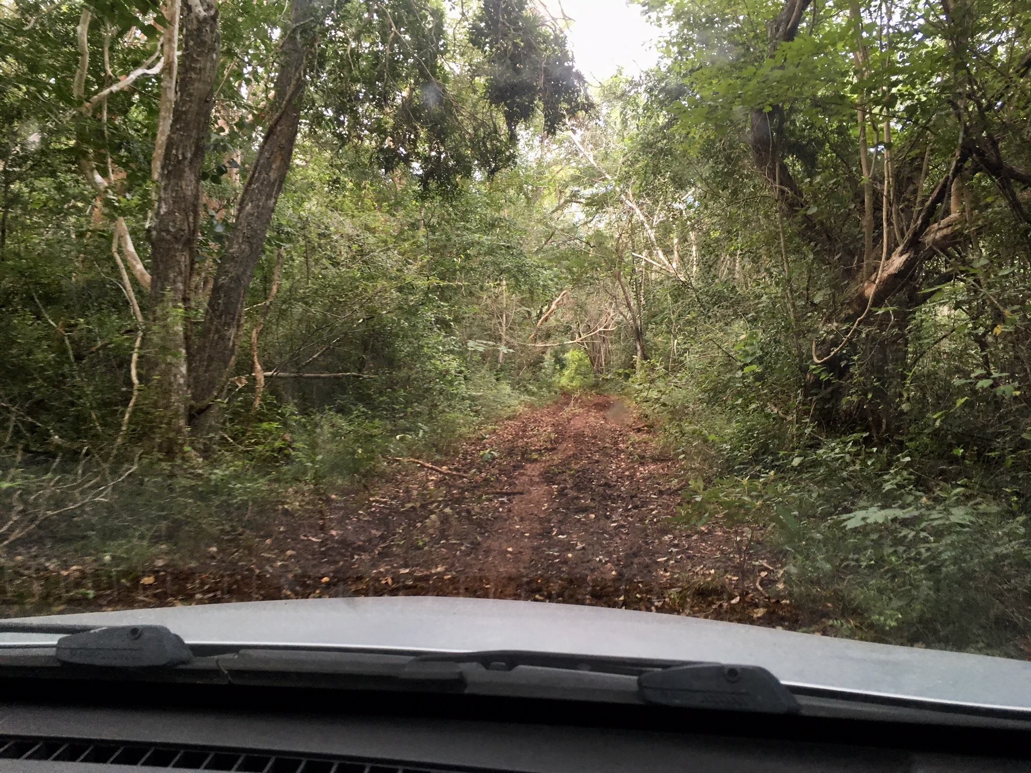
At this point, the road was still OK.
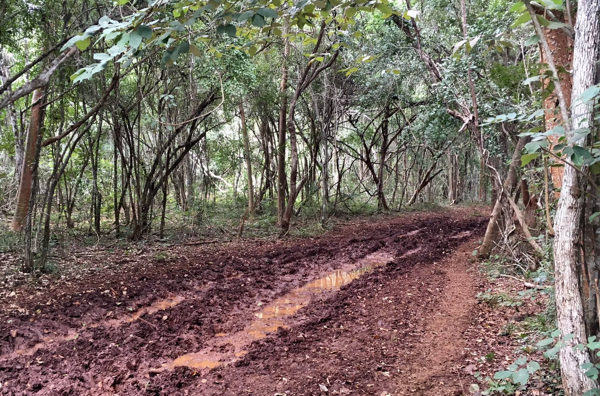
This is where we had to leave the truck; there was no going any further except on foot.

Xkipche was excavated by a team from the University of Bonn and from INAH (Instituto Nacional de Antropología e Historia) between 1990 and 1997 and again from 2002 to 2004. Since then it has not been touched and the jungle is quickly taking over.
Over the next three days, I travelled with Balta, Stephan Merck (for a day) and other friends who came from Campeche and Mérida. The last two days were by far the hottest of the trip - temps in the mid-30s with a humidex, perhaps, in the low 40s. That didn't stop us from exploring Mayan sites in Yucatan and Campeche and our adventures included disturbing a wasp's nest in one of the ruins, coming across a rattlesnake (thankfully, dead), some very sweaty climbs and long walks through the jungle and, of course, amazing ruins.

Rancho Perez, which I first visited in 2014. You can see the infrared image on the camera.

Halal. A large complex, mostly buried in the jungle.
On our trip into Campeche we stopped at the village cemetery of Cumpich. In some villages in Campeche, including this one, there is a tradition of displaying the bones of loved ones. Three years after burial, the body is dug up, the bones are cleaned and are displayed in the wall of the cemetery. Every year on the Day of the Dead, the bones are once again cleaned and redisplayed.
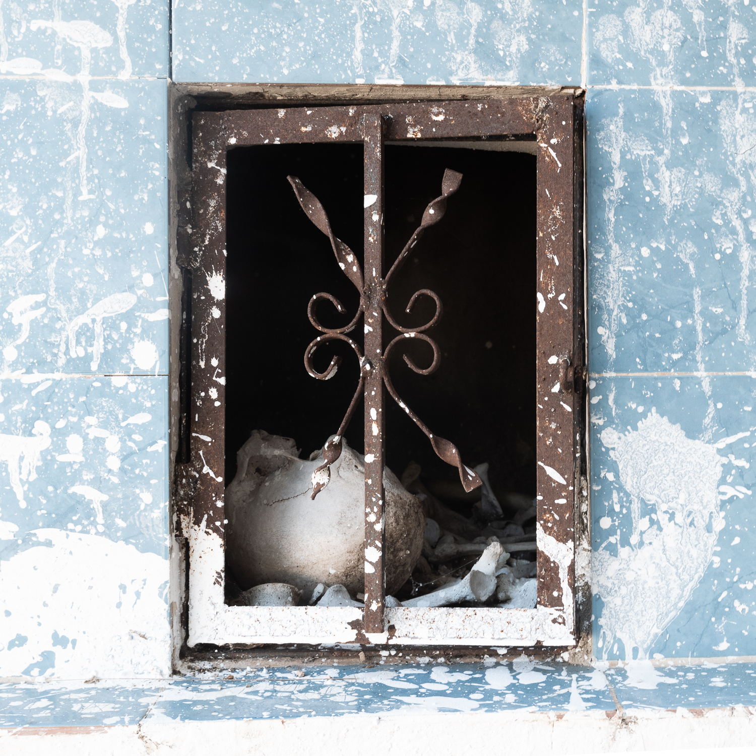
Cumpich cemetery

Cumpich cemetery

Cumpich cemetery
On the last day of the trip we accessed one site through farmers' citrus orchards, while they shouted directions to us across the field, and took a long, hot walk into a second site (total of 14.5 kms walked that day and 43 flights of stairs climbed according to my Fitbit!). Along the road we saw groups of Guadalupanos, who were walking or riding to Mérida (or another town) to celebrate the Day of the Virgin of Guadalupe.
The trip was a great adventure. I saw some amazing ruins, met some wonderful people and got some more infrared images to add to my Mayan ruins series.

Selfie.